
PSR-300 building deformation and displacement monitoring radar (300m monitoring, 3D, PTZ)


PSR-300 building deformation and displacement monitoring radar
(300m monitoring, 3D, PTZ)
|
1.Overview |
| PSR-300-B building deformation and displacement monitoring radar is based on microwave remote sensing and phase interference technology, which can detect displacement, deflection and natural vibration frequency of tall buildings at long distance and non-contact ground. Impact and other indicators are continuously monitored, with fast mobile deployment, sub-millimeter deformation monitoring accuracy, non-contact, not affected by smoke and fire, high data update rate, can monitor the whole building, and the same advantages of multi-unit cooperation, not affected by weather conditions such as rain, snow and fog and low light conditions such as night. It is conducive to early warning and real-time alarm for possible building collapse or serious structural damage, and effectively protect the life safety of rescue workers |
|
2.Application |
| 2.1 Open pit mine, geological landslide/collapse, emergency rescue, water dam, urban subsidence
2.2 Subway traffic, large Bridges, high-rise buildings, wind power tower railway slope, |
|
3.Feature |
| 3.1 Ultra-long range detection
300 meters long distance, and the monitoring accuracy is not affected by distance 3.2 Ultra-high precision monitoring Up to 0.1mm sub-millimeter accuracy, fine monitoring of early fine deformation, more rapid and accurate warning 3.3 High spatial resolution 0.3m×3mrad high resolution, the most accurate monitoring and imaging results more clear and accurate 3.4 All day, all weather, fully automated detection Can be 24 hours, all day, all weather, fully automated detection 3.5 Large viewing Angle monitoring 30 degrees large viewing Angle, wider monitoring range, large area monitoring slope deformation 3.6 Light weight The whole machine adopts an integrated lightweight handheld design, which is easy to transport and deploy |
|
4.Specification |
| 4.1 Host Parameters:
1.Maximum monitoring distance: 300m 2. Deformation monitoring accuracy: sub-millimeter, 0.1mm 3. Data acquisition frequency: ≥100Hz 4. Pixel size: 0.3m×3mrad 5. Monitoring range: 30° 6. Deflection detection accuracy: ±0.05mm 7. Monitoring conditions: 24 hours, automatic detection 8. Power supply requirement: AC220V/DC 48V. 9. Protection level: IP66; 10. Working temperature: -30℃ -60 ℃; 11. With atomic clock level Beidou navigation satellite system timing function, frequency accuracy is better than ±0.5ppb (24-hour measurement results); 12. Radar system integration camera for scene monitoring, camera and radar system connection line is not exposed, video surveillance function interface and radar system control system interface integration, can capture scene images through radar system control system interface; 13. The system connection is simple, and the connection of the radar function modules is routed inside the system as far as possible, and the entire radar system is connected with no more than 4 cables. 4.2 Software Parameters: 1. The local end directly performs data acquisition and deformation processing, and completes the automatic processing of radar echo imaging, interference processing, and small deformation inversion; 2. The software can identify the operating status of the radar and azimuth positioning mechanism, and can view the operating status of the azimuth positioning mechanism and scan the operating position through the software in real time; 3. It can realize the registration of radar monitoring data and three-dimensional terrain, and automatically register according to the submitted point cloud data; Support UAV modeling, CAD 3D modeling, laser 3D point cloud modeling data and radar data fusion; 4. Effective management of monitoring data, able to query and analyze data on time, day, week and month; 5. Provide 3D visual operation interface, users can carry out single point, regional data analysis; 6. Provide point-by-point and region-by-area analysis of displacement, velocity and acceleration; 7. With deformation color display, mail alarm, SMS alarm warning mode; 8. Can select the extreme value, the mean value of deformation, deformation speed, acceleration curve display function, the extreme value and the mean value can be displayed separately, or can be displayed in combination; 9. The alarm threshold can be set according to the deformation value, deformation speed, deformation acceleration, cumulative deformation value and other alarm variables. The selection of alarm variables can be selected either individually or any combination thereof, and the alarm time interval can be set; 10. The monitoring area selection method provides linear polygon, curve polygon, etc., which can indicate the position of at least three points of the maximum deformation in the area, and can display the deformation, deformation speed and deformation acceleration curve of the maximum deformation point; 11. It can diagnose the overall operating status of the radar system and provide the status and diagnostic information, and can real-time monitor the radar waveform state, data coherence quality, scanning position operating status, and realize the rapid positioning of the fault module; 12. Provide a variety of data display and query methods: real-time data, daily data, weekly data, monthly data, annual data; 13. It has the function of air-varying atmospheric phase distributed correction and multi-stage slope interference phase unwinding; 13.1 Can diagnose the overall operating status of the radar system and provide status and diagnostic information, can real-time monitor the radar waveform state, data coherence quality, scanning position operating status, can achieve rapid fault module positioning. |
|
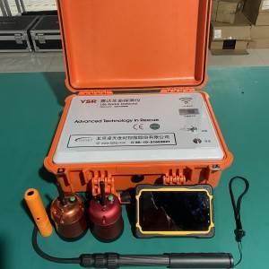
5.Packing list |
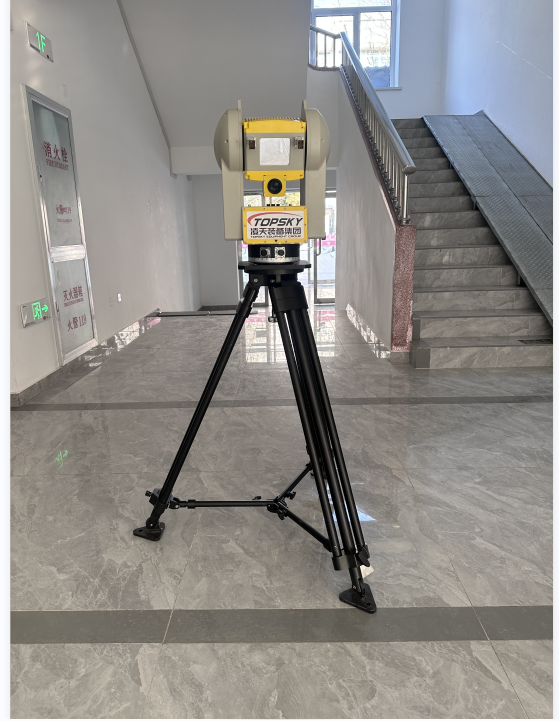
| 1. Monitoring radar host 1 set
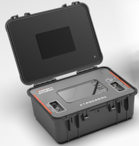
2. 1 set of main control box 3. 1 set of rotating structure 4. Fix 1 set of tripod 5. 1 set of data analysis and warning software
|